Aviation Weather
full text of the classic FAA guide
PRESSURE GRADIENT FORCE
Pressure differences must create a force in order to drive the wind. This force is the pressure gradient force. The force is from higher pressure to lower pressure and is perpendicular to isobars or contours. Whenever a pressure difference develops over an area, the pressure gradient force begins moving the air directly across the isobars. The closer the spacing of isobars, the stronger is the pressure gradient force. The stronger the pressure gradient force, the stronger is the wind. Thus, closely spaced isobars mean strong winds; widely spaced isobars mean lighter wind. From a pressure analysis, you can get a general idea of wind speed from contour or isobar spacing.
Because of uneven heating of the Earth, surface pressure is low in warm equatorial regions and high in cold polar regions. A pressure gradient develops from the poles to the Equator. If the Earth did not rotate, this pressure gradient force would be the only force acting on the wind. Circulation would be two giant hemispheric convective currents as shown in figure 19. Cold air would sink at the poles; wind would blow straight from the poles to the Equator; warm air at the Equator would be forced upward; and high level winds would blow directly toward the poles. However, the Earth does rotate; and because of its rotation, this simple circulation is greatly distorted.
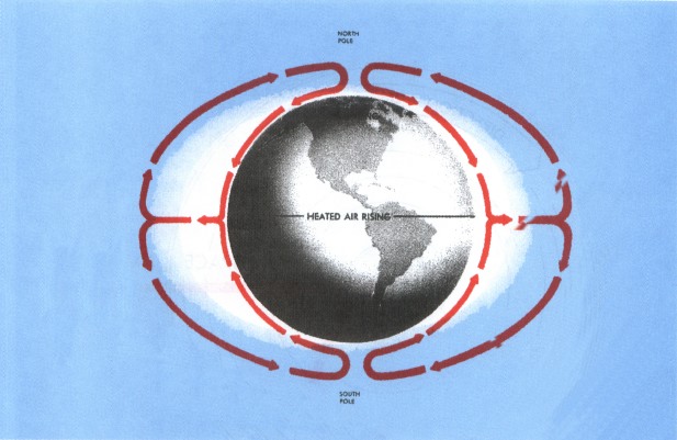
Table of Contents
Previous Section: Convection
Next Section: Corious Force
A PDF version of this book is available here. You may be able to buy a printed copy of the book from amazon.com.