Aviation Weather
full text of the classic FAA guide
WATER VAPOR
Water evaporates into the air and becomes an ever-present but variable constituent of the atmosphere. Water vapor is invisible just as oxygen and other gases are invisible. However, we can readily measure water vapor and express it in different ways. Two commonly used terms are (1) relative humidity, and (2) dew point.
RELATIVE HUMIDITY
Relative humidity routinely is expressed in percent. As the term suggests, relative humidity is “relative.” It relates the actual water vapor present to that which could be present.
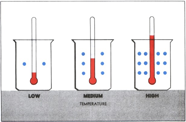
Temperature largely determines the maximum amount of water vapor air can hold. As figure 32 shows, warm air can hold more water vapor than cool air. Figure 33 relates water vapor, temperature, and relative humidity. Actually, relative humidity expresses the degree of saturation. Air with 100% relative humidity is saturated; less than 100% is unsaturated.
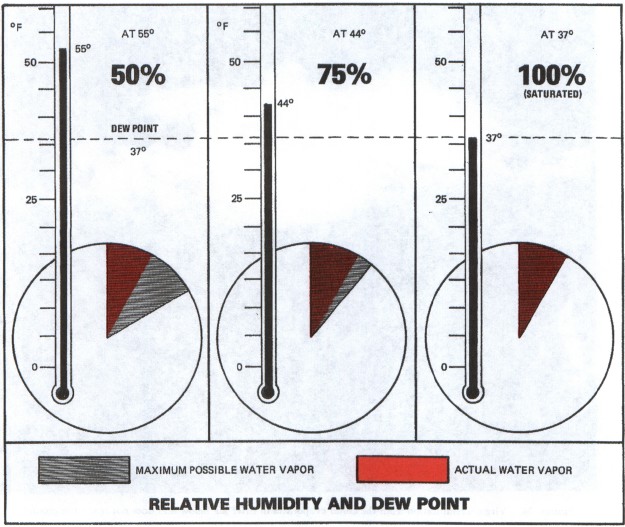
If a given volume of air is cooled to some specific temperature, it can hold no more water vapor than is actually present, relative humidity becomes 100%, and saturation occurs. What is that temperature?
DEW POINT
Dew point is the temperature to which air must be cooled to become saturated by the water vapor already present in the air. Aviation weather reports normally include the air temperature and dew point temperature. Dew point when related to air temperature reveals qualitatively how close the air is to saturation.
TEMPERATURE-DEW POINT SPREAD
The difference between air temperature and dew point temperature is popularly called the “spread.” As spread becomes less, relative humidity increases, and it is 100% when temperature and dew point are the same. Surface temperature-dew point spread is important in anticipating fog but has little bearing on precipitation. To support precipitation, air must be saturated through thick layers aloft.
Sometimes the spread at ground level may be quite large, yet at higher altitudes the air is saturated and clouds form. Some rain may reach the ground or it may evaporate as it falls into the drier air. Figure 34 is a photograph of “virga”—streamers of precipitation trailing beneath clouds but evaporating before reaching the ground. Our never ending weather cycle involves a continual reversible change of water from one state to another. Let's take a closer look at change of state.
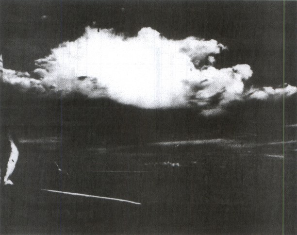
Table of Contents
Previous Section: Moisture Cloud Formation and Precipitation
Next Section: Change of State
A PDF version of this book is available here. You may be able to buy a printed copy of the book from amazon.com.